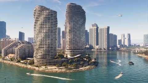
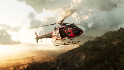
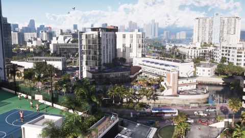
GTA 6's map is about 175 km², about 16 by 10.9 km, and roughly 35% of it is water, by PowerPyx's measure (PowerPyx). That fits what Rockstar said before launch: nearly as big as GTA IV, GTA V and Red Dead 2 combined. Kotaku crossed it from south to north: 3 hours 21 minutes walking, 1 hour 41 running, about 11 minutes by car on the highway and under 6 minutes in a prop plane, against about 8 minutes driving across GTA V (Kotaku).
The five counties#
| County | What's in it |
|---|---|
| Mariana | The south: Key Lento, Southwind, Pelican Valley, Grassrivers, Capri |
| Vice-Dale | Vice City, Vice Beach and the airport, VCIA |
| Kelly | Port Gellhorn, Draper Island, Frogswater |
| Leonard | Belville, Waning Sands, Lake Leonida |
| Lummox | Grayson, Bonanza, Millport, Mount Kalaga National Park |
County names are from PowerPyx's map, and the SVG and Game Rant reviews name some of them too. Ambrosia, one of Rockstar's six pre-launch regions, isn't on PowerPyx's map yet, so we're keeping it where it is on ours until it's placed.
How the map opens up#
The map starts covered in fog, and you clear it by exploring. Flying is the quickest way (Game Rant). Clearing all of it earns a trophy. Reviews say you can travel almost anywhere early on. You can also fast travel by taxi or the RydeMe app, paying about $100 to skip the ride (Screen Rant). Our own map is being updated with what's confirmed in the game.
Before launch: what we expected#
This is what we wrote before launch, when only estimates existed.
Rockstar's own comparison: Leonida's landmass, Vice City included, is nearly as big as the playable maps of GTA IV, GTA V and Red Dead Redemption 2 put together. Rockstar said that to Edge magazine for its issue 430 cover story, on sale from 29 October. Aaron Garbut, co-head of Rockstar North, also told Edge the game has "an order of magnitude more interiors" than earlier ones. What Rockstar still hasn't given is an actual area in square miles or kilometres, so every precise number you see is an estimate.
What Rockstar has said
| Claim | Source | Status |
|---|---|---|
| Landmass nearly GTA IV, GTA V and RDR2 combined | Rockstar to Edge, issue 430 | Official comparison |
| Far more interiors than before | Aaron Garbut to Edge | Official, no count given |
| An area in square miles or km | None | Not published |
How many of those interiors you can walk into is covered in how many buildings can you enter.
The estimates in circulation
Before the Edge story, three comparisons turned up most often in coverage:
- The whole map is about twice the size of GTA V's.
- The landmass is about three times Red Dead Redemption 2's.
- Vice City alone is about twice the size of Los Santos.
All three are estimates, not Rockstar figures. We print them on the site with that word attached every time.
Why they don't line up
The first two are hard to reconcile at a glance. Most of the gap comes from what each estimate is measuring.
Different baselines. "Twice GTA V" compares against a whole game map. "Three times RDR2's landmass" compares against land only. Those are different measurements of different things, so the multiples won't match.
Water. Leonida is a coastal state with islands, wetlands and open sea. Whether you count water changes the answer a lot. The Keys are islands with sea between them. Grassrivers is wetland, which sits somewhere between land and water depending on who's counting.
City versus state. "Twice Los Santos" is about Vice City only, not the whole map. It's a separate claim and shouldn't be multiplied up into a figure for Leonida.
Footage, not files. Estimates made before launch rely on trailers, screenshots and the extended look. That means guessing scale from what's on screen, and even the map HUD in the extended look, with its buildings drawn in 3D, wasn't presented as a scale drawing. Small errors in reading distance add up fast over a large area.
What size actually means for you
A bigger number isn't the same as more to do. A map with a lot of open water might measure huge and play smaller. A dense city might measure modest and take longer to explore than an empty one twice its size.
For our purposes, the more useful questions are practical. How long does it take to drive from Vice City to the Keys? How much of Grassrivers can you reach by road? How far north does Mount Kalaga go? Those are things we can measure ourselves.
What we'll measure after launch
Once we can play, we plan to:
- Time the main drives between regions at normal speed, and publish the route we used.
- Note what needs a boat. If part of a region can only be reached by water, that's more useful to know than a square-mile figure.
- Mark region borders as the game itself shows them, rather than as fan maps drew them.
- Compare our own measurements against official figures, if Rockstar ever publishes any.
We won't publish a square-mile or square-kilometre number unless we can show how we got it. If Rockstar releases a figure, it goes on the Leonida hub with the source.
The regions involved
For reference, the six named regions are Vice City, the Leonida Keys, Grassrivers, Port Gellhorn, Ambrosia and Mount Kalaga. Their borders aren't confirmed, so the outlines on our map are approximate.
Until then
Treat any precise figure you see before launch with suspicion, including figures quoted to a decimal place. The honest version is Rockstar's own: close to three of its earlier maps put together. Anything sharper is a guess dressed up.
If you've got a method for measuring the map after launch, we'd like to hear it. Post it on the forum.